Alaska & Canada to Wisconsin, July 2007, part 2
Monday, 16-Jul
The friendly Illinois couple also said that the Fairbanks International
Airport was a great place to camp under the wing with hot showers even
(which was starting to sound real good). So we broke camp and headed for
Fairbanks. The weather was better than we had seen so far, so we thought
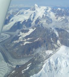
this might be our best chance to fly up the glaciers on Mt. McKinley.
Soon we could see that McKinley was completely clear (a rare event).
Pictures taken enroute to Mt. McKinley.
We started flying up the Ruth glacier maintaining 7000 feet until forced
to climb by rising terrain. It was somewhat intimidating seeing these huge
walls of granite rising well above on both sides, but I could see that
there was generous space to turn around in case there was some kind
of trouble. I was also glad that Kimball had given me a map of McKinley
with the frequencies and reporting points used by the tour operators
(although I admit to not knowing exactly where I was most of the time).
Pictures taken flying up the Ruth glacier.
Pictures taken circling the rest of McKinley.
While circling the mountain it looked overcast towards Fairbanks as far
as we could see and there weren't any obvious holes to duck under, so
we went to Anchorage (Merill Field) instead. Just after we called Anchorage
approach my slate computer moving map display lost its position. Later
I realized why - ever since we left James' house in OR, I had forgotten
to charge or swap batteries in the bluetooth GPS puck velcroed to the glare
shield. It would have been handy negotiating the complicated Anchorage
airspace. At least the old (and currently intermittent) panel-mounted
GPS (Northstar) was behaving itself. Also the controllers were quite
gentle with us after I said "unfamiliar with the area".
While we were refueling at the cheapest self-serve, one of the workers at the FBO
was bubbling over with amazement to see a Skywagon with wheel pants. He
claimed that he had never seen that before. I can understand that with the
kind of flying most Skywagon pilots do up here, but I told him it is not
nearly so unusual in the lower 48.
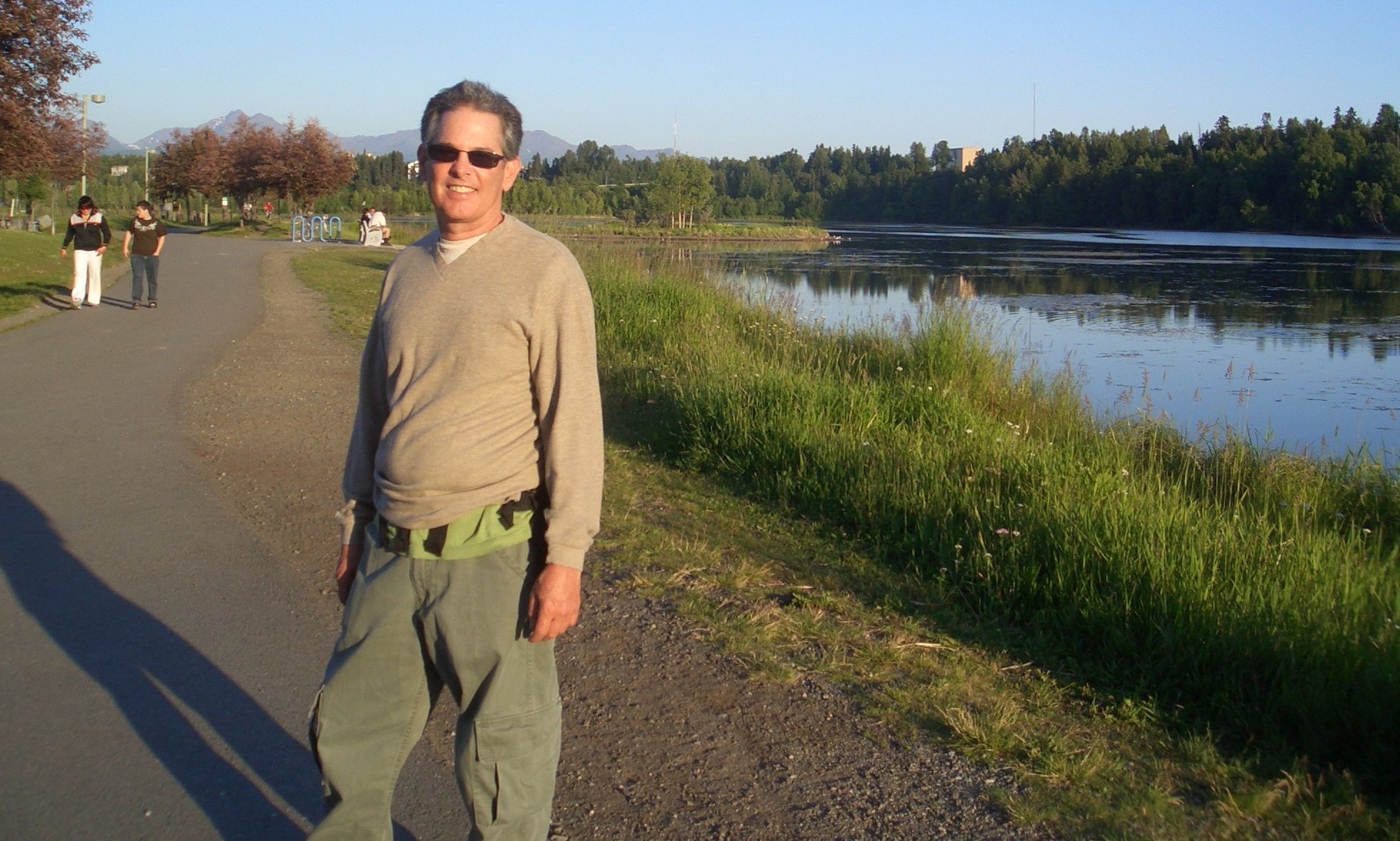
We booked a hotel room right at the field (Ace Hangers) and rented a car.
Today was mostly a day to regroup ... restocking our supplies at the
grocery store, getting an airline reservation for Marty's return, going
out for lunch (fantastic fresh salmon and halibut - but not cheap),
checking email, etc.
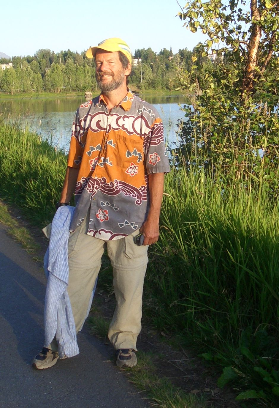
 At 9pm we left for a few hour hike along one of the
coastal trails - our only real activity for the day. It still amazes me
that we have so much daylight. Small kids were out on their bicycles
with their parents even at 11pm.
At 9pm we left for a few hour hike along one of the
coastal trails - our only real activity for the day. It still amazes me
that we have so much daylight. Small kids were out on their bicycles
with their parents even at 11pm.


Back at the hotel we made dinner from our grocery supplies. Then I took
advantage of the internet connection to research cameras. I only asked
Marty to bring one thing (a camera), but it had only one postage stamp
size battery, and he didn't bother to bring the charger. (Gee we were
already nearly out of battery power).
Tach: 2.7
Hobbs: 3:10
Gallons: 48.61
Cost: $194.41
Track: (200.2 / 411 nm)
McCarthy-Anchorage.kmz
Tuesday, 17-Jul
In the morning I was moments away from ordering the Casio S770 online with
overnight delivery to the Ace hanger when the power failed. The power was
restored but the internet connection never was. I didn't even have their
phone number so I abandoned the idea. We checked out, returned the car and
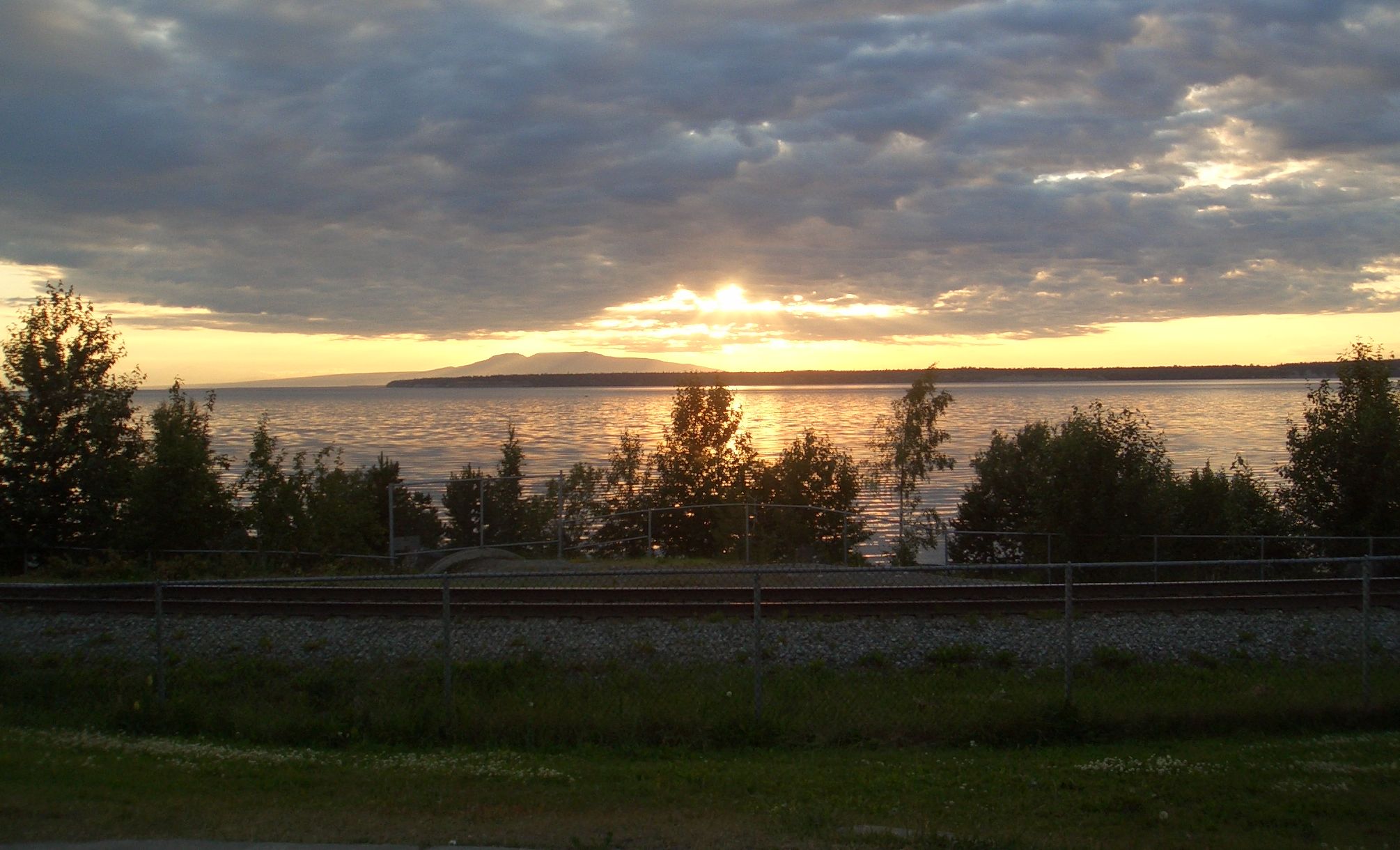
departed for Minchumina, a town (population 16) on a lake about 1.5 hours
to the north. Took us a little longer however since we deviated west
(over Rainy Pass) so we could stay under the overcast (barely). Not being
in a rush, we throttled back to 10gph - the power setting I always used to
use before getting the turbonormalizer.
Pictures taken enroute to Minchumina.
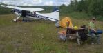
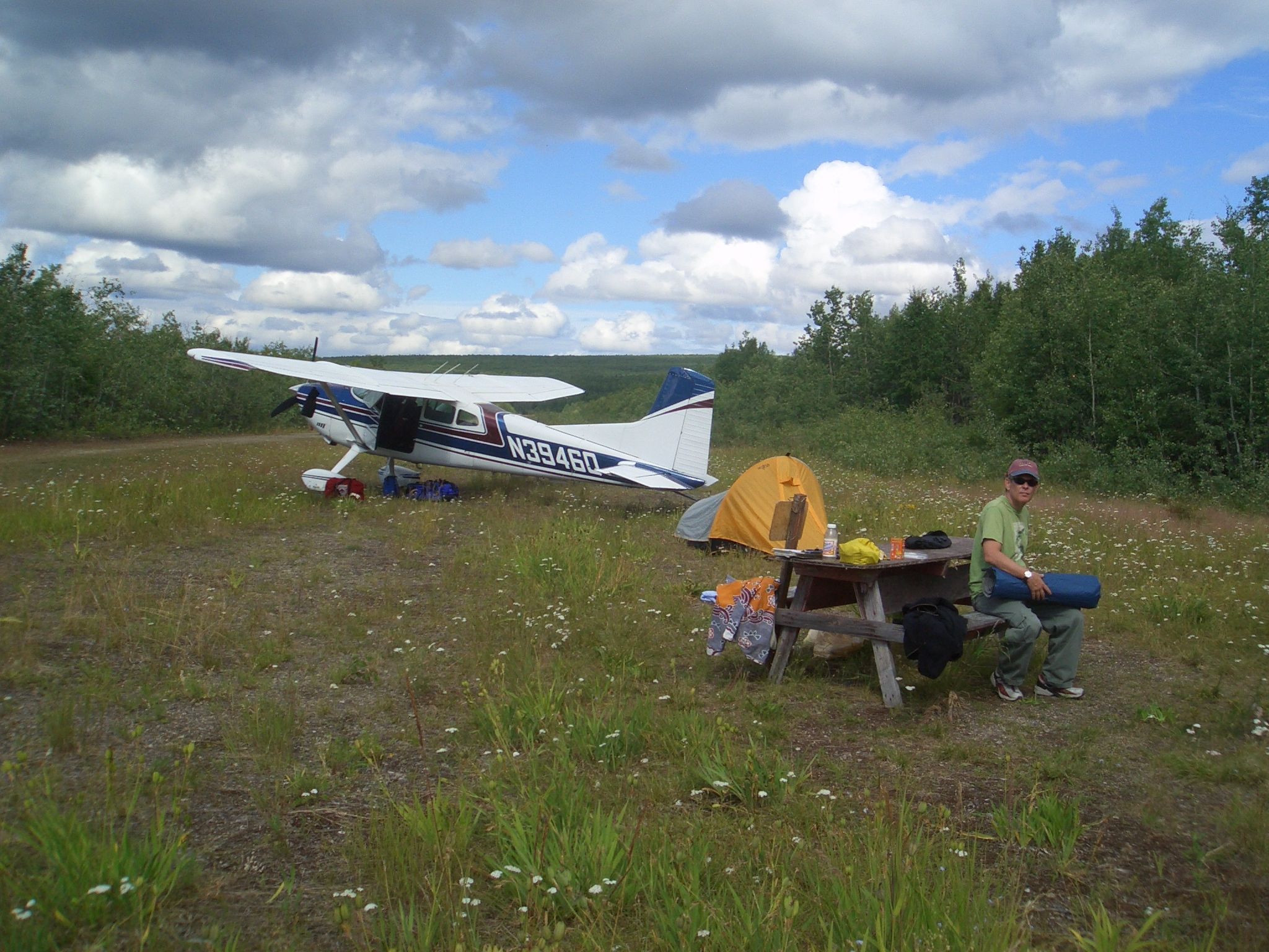
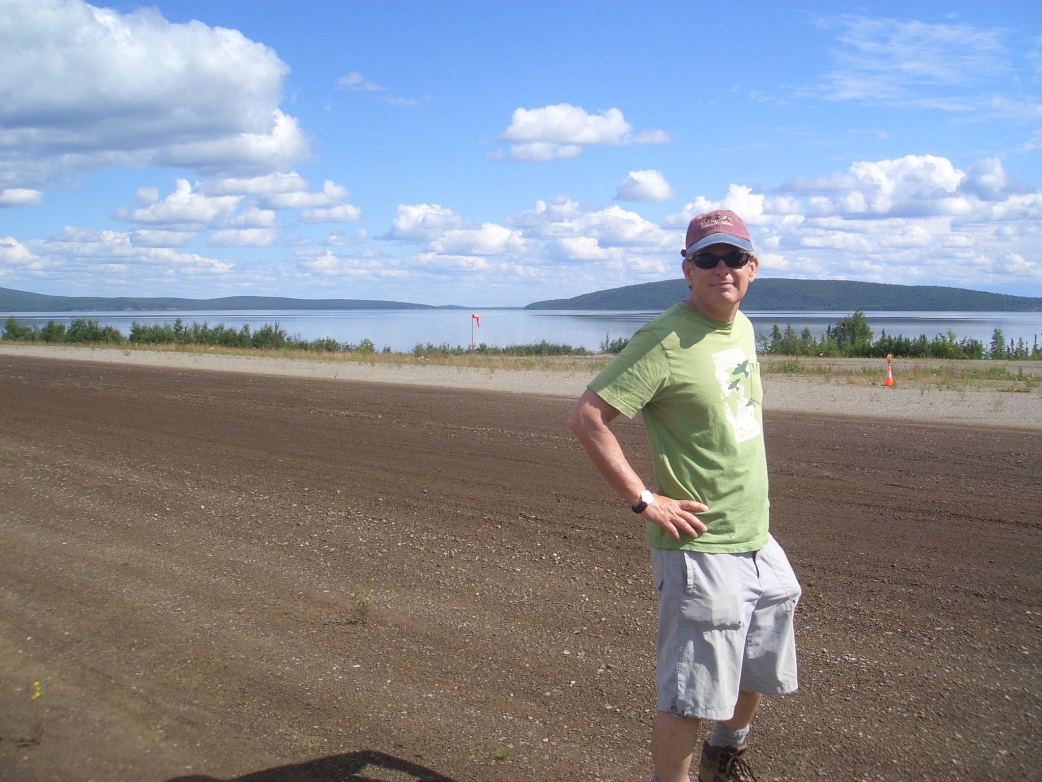
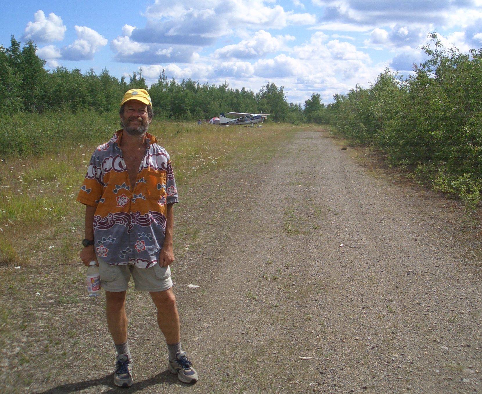
 Landed on 25, the main dirt runway,
taxied past the parking area (with 2 planes), turned left on the old runway
along the lake to the picnic table at the far end. A beautiful camping spot
all to ourselves (another tip from the Illinois couple). We set up camp and
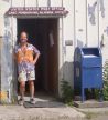
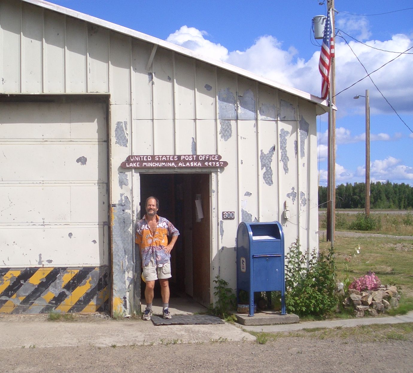
walked into town ... i.e back to the main runway. Astonished to find an open
and staffed post office as well as a library with a computer (compliments of
Bill & Milinda Gates we were told). No running water however - Only in AK :)
Landed on 25, the main dirt runway,
taxied past the parking area (with 2 planes), turned left on the old runway
along the lake to the picnic table at the far end. A beautiful camping spot
all to ourselves (another tip from the Illinois couple). We set up camp and
walked into town ... i.e back to the main runway. Astonished to find an open
and staffed post office as well as a library with a computer (compliments of
Bill & Milinda Gates we were told). No running water however - Only in AK :)
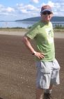
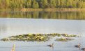
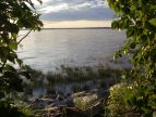
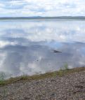
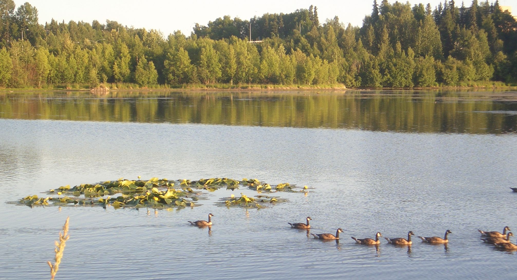
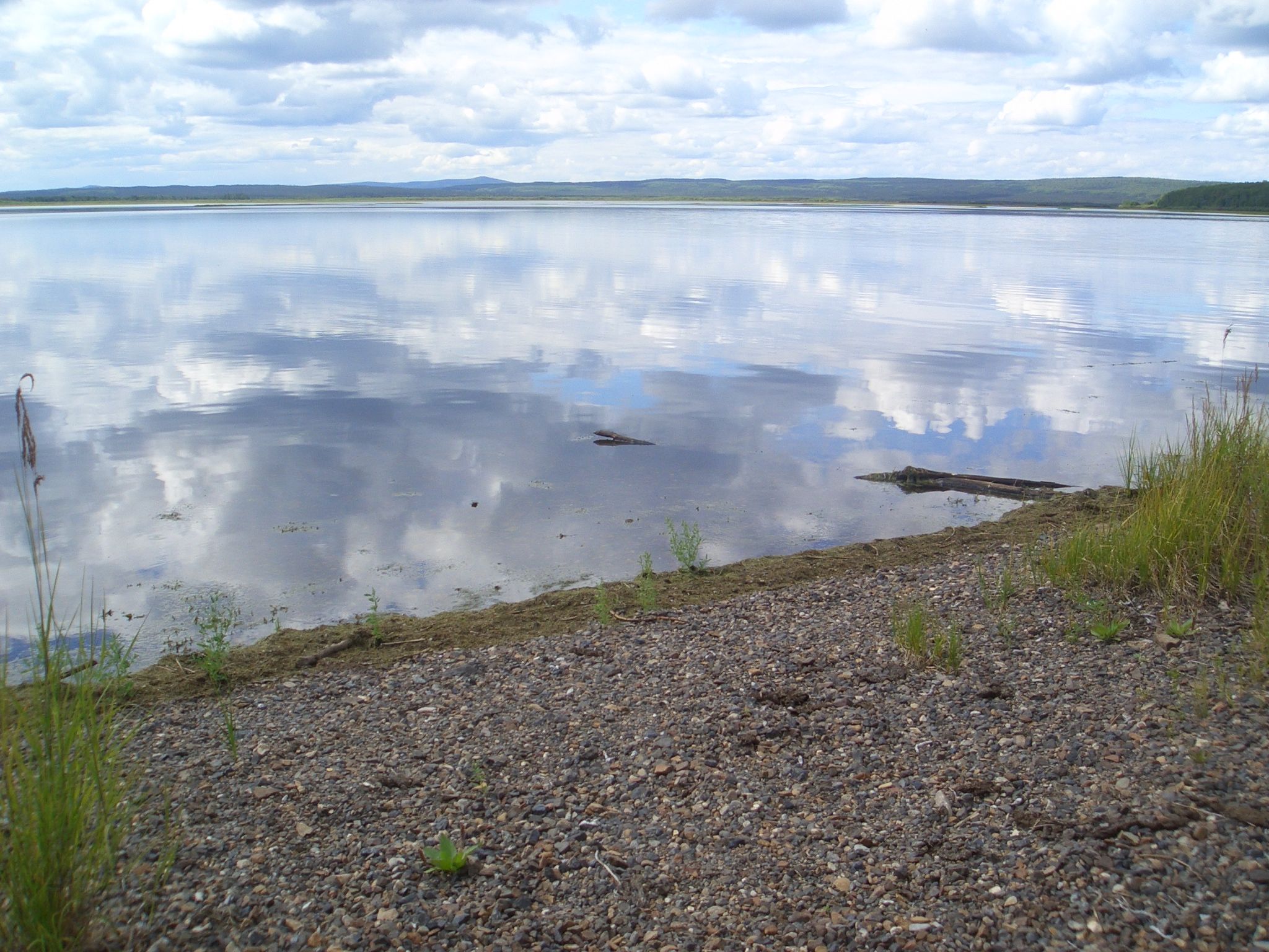
 We walked part way around the lake in the hot sun, so the short swim back
at our camp site was quite refreshing. (Didn't manage to talk Marty into
joining me however.) I thought the water would be glacial, but there wasn't
even a shock jumping in. Quite pleasant. The rest of the day we just hung
out and relaxed and finished reading yesterday's newspaper. The bugs were
just about getting to the nuisance level, so I got out the insect repellent
for the first time. Quite effective (thanks Susan!).
We walked part way around the lake in the hot sun, so the short swim back
at our camp site was quite refreshing. (Didn't manage to talk Marty into
joining me however.) I thought the water would be glacial, but there wasn't
even a shock jumping in. Quite pleasant. The rest of the day we just hung
out and relaxed and finished reading yesterday's newspaper. The bugs were
just about getting to the nuisance level, so I got out the insect repellent
for the first time. Quite effective (thanks Susan!).
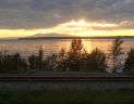
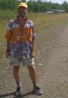
 At about 9pm the winds
picked up suddenly and drastically. Hmm ... maybe we should have tied the
airplane down after all. Scurried around to get the airplane well chocked
and everything under the wing before the rain hit. Marty had the bright
idea of moving the picnic table under the wing, which made cooking and
eating quite comfortable. The storm soon blew away and it got light again.
In fact it never really seemed to get dark. This was at 64 degrees latitude,
as far north as we got. I was reading until 1:30am and never even considered
getting out the flashlight.
At about 9pm the winds
picked up suddenly and drastically. Hmm ... maybe we should have tied the
airplane down after all. Scurried around to get the airplane well chocked
and everything under the wing before the rain hit. Marty had the bright
idea of moving the picnic table under the wing, which made cooking and
eating quite comfortable. The storm soon blew away and it got light again.
In fact it never really seemed to get dark. This was at 64 degrees latitude,
as far north as we got. I was reading until 1:30am and never even considered
getting out the flashlight.
Tach: 1.6
Hobbs: 1:56
Gallons: 0.00
Cost: $000.00
Track: (173.7 / 214 nm)
Anchorage-Minchumina.kmz
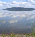
Wednesday, 18-Jul
 Woke up to overcast skies, but soon we could see a bit of encouraging blue
sky to the north east. Not enough sun to dry off our tents, so we rolled
them up wet and threw them into the back of the airplane. Pretty good
weather once we climbed above the broken layer and once again we were lucky
to have clear weather over the mountains as you can see from this picture.
The camera battery just gave up the ghost so this is the last picture for
awhile. This was an older Casio ultra-portable camera not known for its
exceptional picture quality, so I hope the pictures came out well. So far,
I've just viewed them on the small screen of my slate computer.
Woke up to overcast skies, but soon we could see a bit of encouraging blue
sky to the north east. Not enough sun to dry off our tents, so we rolled
them up wet and threw them into the back of the airplane. Pretty good
weather once we climbed above the broken layer and once again we were lucky
to have clear weather over the mountains as you can see from this picture.
The camera battery just gave up the ghost so this is the last picture for
awhile. This was an older Casio ultra-portable camera not known for its
exceptional picture quality, so I hope the pictures came out well. So far,
I've just viewed them on the small screen of my slate computer.
There were breaks in the clouds over Anchorage, so not much trouble
descending for the landing. It was easier this time since we now knew the
expected approach over the sunken ship and the downtown buildings to stay
out of the military field's airspace.
We rented the exact same car we rented on Monday and decided to go off
somewhere to camp. We took one suggestion (from the hotel office manager)
to go to the Portage Glacier in Chugach State Park - just an hour or so to
the south east. We walked several of the trails in the on & off again rain
and even walked a little ways up the Portage Glacier. That was cool. (Ok,
Marty, now I'm REALLY regretting not having a camera).
About the time we were looking around for a good campsite, another light
drizzle began. The thought of putting up our sopping wet tents suddenly
seemed less appealing. So we did a bit more sightseeing in this beautiful
area (including an unintentional trip thru the tunnel to Whittier where
all the cruise ships arrive and depart) and then drove back to Anchorage.
The office at the Ace hanger hotel was closed but our call was forwarded
to the office manager. She told us that our old room was still unoccupied
and our credit card is still on file, so just go ahead and use our old
access codes to get in. This hotel seems to be little known and the best
deal in town. (Everything else that we checked out was already booked.)
Tach: 1.4
Hobbs: 1:37
Gallons: 36.48
Cost: $145.88
Track: (173.7 / 181 nm)
Minchumina-Anchorage.kmz
Thursday, 19-Jul
Today Marty has to catch his United flight back to SFO. As I prepare to
depart for Juneau, Marty laments that he is going to go into Cessna
withdrawal. As he helped me load up the airplane, we talked about how
we made a great flying team. If at any point one of us had doubt about
what to do next, the other was sure to have a good idea. We also talked
about how well the trip went - covering a lot of interesting ground over
the last five and a half days while adding 18 hours of time to the tach -
and how random it seemed. If we had departed an hour earlier or later, we
would have talked with different people along the way, heard different
suggestions and probably would have gone to different places. We decided
it was a good thing that neither of us had enough time to do much
actual planning. Having no plan made it easier and more necessary to
seek out the experience of those around us, and to be open for whatever.
It seems that preconceived plans don't work well in Alaska anyway
because of the vagaries of the fast-changing weather. The other thing
that helps this discovery process is that there are so many pilots
and airplanes here. The guy renting us a car had a C185 in his hanger.
The guy sitting next to us at the fish restaurant said he had several
airplanes (including a C185) and his girlfriend was a student pilot.
Aviation is simply everywhere you look.
The flight to Juneau was stunning. It was one of those "VFR not recommended
due to Mtn. obscurement" kind of days, according to flight service, yet
the flying was not difficult. Just some low clouds over the coast - nothing
that would affect the flight. Cordova was fogged in, but Yakutat (a
popular fuel stop for this route) was clear despite the report otherwise.
Approaching Juneau, it sure looked overcast and I was tempted to fly
under the overcast layer 50 miles out and scud run the rest of the way.
However Juneau was reporting just broken layers, so I trusted the report
and took the easy way in. The trust panned out. Sure enough by 15 miles out,
things opened up for an easy arrival. The 4.5 hour flight was my longest
of the trip. Only 490 nm, but I was going slow (10-11gph) to save gas
and there was a 8-9 knot head wind besides. That's ok, since I enjoyed
every minute! Fortunately I had stopped at the Office Max before departure
from Anchorage and picked up a two pack of 27 exp. disposable cameras.
With great restraint, I managed to use up only the first camera on the
flight to Juneau. You can tell that these pictures were taken thru a lens
on a $10 camera, so it takes even more imagination than usual to visualize
the true splendor. Note the float plane landing area parallel to the
pavement runway at Juneau airport.
Pictures taken enroute to Juneau.
I had noted some interesting trails nearby, and my plan was to rent a
car and find a campsite, and check out some of the trails. However the
weather convinced me otherwise. Shortly after I landed the sky turned
dark, and it started raining. It never stopped the entire time I was
in Juneau. So I stayed dry and comfortable in the Super 8 - what
appeared to be the last hotel room available in Juneau.
Tach: 3.9
Hobbs: 4:44
Gallons: 43.00
Cost: $236.97
Track: (490.5 / 502 nm)
Anchorage-Juneau.kmz
Friday, 20-Jul
Woke up at 6:30, took one look out the window (rain, fog, mist, indefinite
ceiling, yuck) and went back to bed. Still pretty much the same at 9, but
the FSS thought there would be some improvement. Another hour or so it
improved to 1300 and 4mi, so I filed a flight plan and headed to the airport.
Unfortunately the hotel driver couldn't be found. Eventually I got someone
from the FBO to pick me up, but I had missed the small window. Some planes
were taking off as I pre-flighted, but by the time I started the engine,
the ATIS was reporting 700 and 3mi and nobody was taking off. Walking around
in the rain until 4pm, I finally called the Super 8 to see if my room
was still available, but I just got a busy signal. While I was dithering
the wx went back to 1300 and 4 and some planes were taking off again. It
was hard for me to see where in the heck they were going, but I decided
to at least do a pattern circuit. On downwind I could see that the visibility
over the water was better, so I ventured out of the pattern.
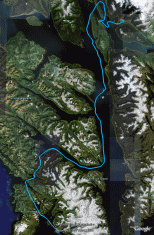
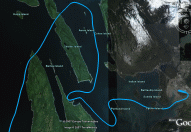
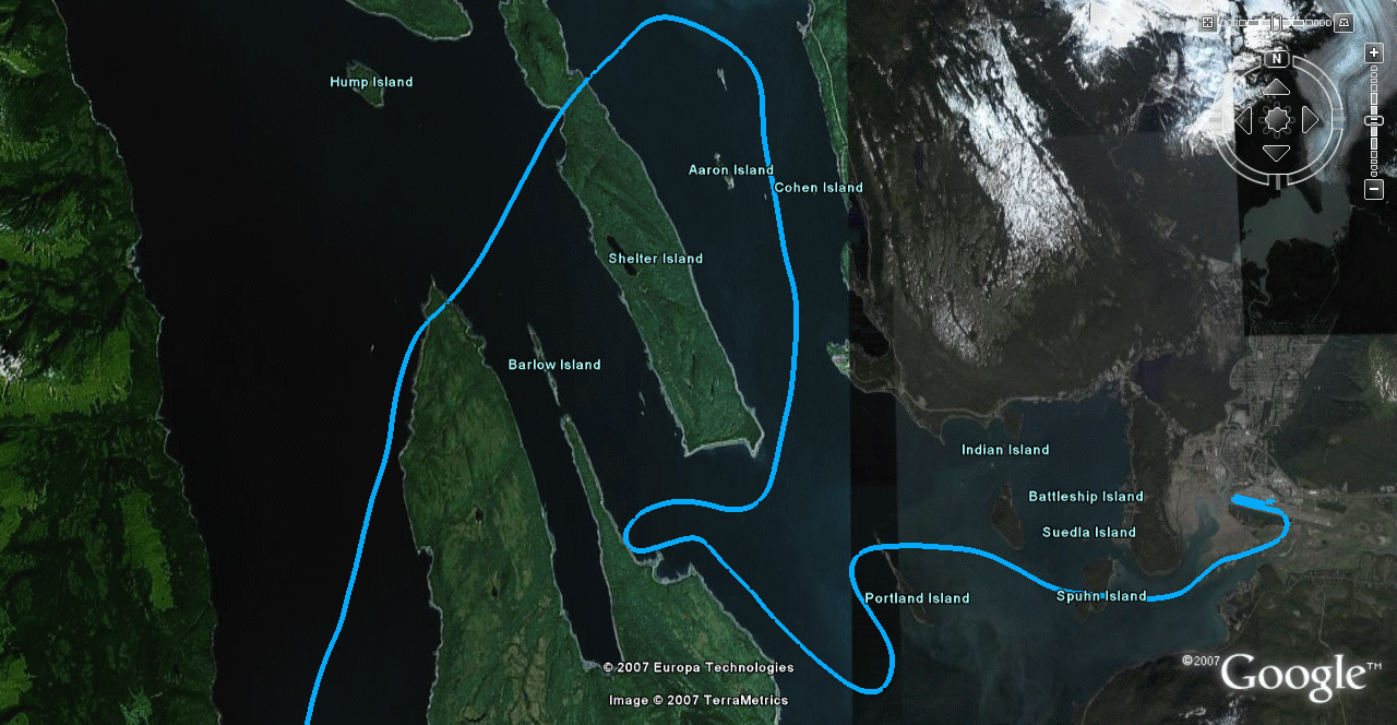
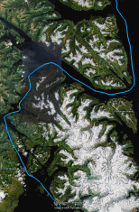 My route can be seen in the picture to the left. The middle picture is a closer view
of the first half of the flight, and the one on the right is of the second half.
Click on all these pictures for a larger image. To see the route in even more detail,
install the free Google Earth and click on the kmz below.
My route can be seen in the picture to the left. The middle picture is a closer view
of the first half of the flight, and the one on the right is of the second half.
Click on all these pictures for a larger image. To see the route in even more detail,
install the free Google Earth and click on the kmz below.
The flight briefer did not recommend VFR, especially after he figured out
that I had never flown the route before. Yet I knew that I would not get
lost in the channels, and that I could find my way back to Juneau if I
could not make it to Sitka. A local pilot told me there were no clouds
below 600 ft over the channel. (I considered IFR only briefly. Icing seemed
likely.) As I proceeded over the channel, the only thing that really worried
me was the possibility of an engine failure. One can't survive in this
cold water for long. I was wearing my life jacket and I put my GPS personal
locator beacon in one pocket and my strobe light in the other. I was able to
remain within gliding distance of shore or a ship most of the time, so I
pressed on (never getting higher than about 1000 feet). 1.5 hours later when
I finally reached Sitka, I couldn't remember being more pleased to find the
airport - even including my first student cross country flights.
Since it was not a long flight, I didn't take on that much fuel, yet
the FBO offered me the courtesy car. Very handy. I thought I might be
sleeping in it, (Like Juneau, the hotels fill up fast during prime
tourist season.) Each hotel I drove to sent me to another purported to
have rooms left. On the fifth one, there was one room left which I
gladly took.
Tach: 1.2
Hobbs: 1:22
Gallons: 19.10
Cost: $106.96
Track: (82.4 / 155 nm)
Juneau-Sitka.kmz
Click here to continue to part 3 (Saturday, 21-Jul).
Click here to skip ahead to part 4 (Saturday, 21-Jul).
Click here to go back to part 1 (Friday, 13-Jul).
Click here to go back to the mennen.org home page.
 At 9pm we left for a few hour hike along one of the
coastal trails - our only real activity for the day. It still amazes me
that we have so much daylight. Small kids were out on their bicycles
with their parents even at 11pm.
At 9pm we left for a few hour hike along one of the
coastal trails - our only real activity for the day. It still amazes me
that we have so much daylight. Small kids were out on their bicycles
with their parents even at 11pm.
 Landed on 25, the main dirt runway,
taxied past the parking area (with 2 planes), turned left on the old runway
along the lake to the picnic table at the far end. A beautiful camping spot
all to ourselves (another tip from the Illinois couple). We set up camp and
walked into town ... i.e back to the main runway. Astonished to find an open
and staffed post office as well as a library with a computer (compliments of
Bill & Milinda Gates we were told). No running water however - Only in AK :)
Landed on 25, the main dirt runway,
taxied past the parking area (with 2 planes), turned left on the old runway
along the lake to the picnic table at the far end. A beautiful camping spot
all to ourselves (another tip from the Illinois couple). We set up camp and
walked into town ... i.e back to the main runway. Astonished to find an open
and staffed post office as well as a library with a computer (compliments of
Bill & Milinda Gates we were told). No running water however - Only in AK :)
 We walked part way around the lake in the hot sun, so the short swim back
at our camp site was quite refreshing. (Didn't manage to talk Marty into
joining me however.) I thought the water would be glacial, but there wasn't
even a shock jumping in. Quite pleasant. The rest of the day we just hung
out and relaxed and finished reading yesterday's newspaper. The bugs were
just about getting to the nuisance level, so I got out the insect repellent
for the first time. Quite effective (thanks Susan!).
We walked part way around the lake in the hot sun, so the short swim back
at our camp site was quite refreshing. (Didn't manage to talk Marty into
joining me however.) I thought the water would be glacial, but there wasn't
even a shock jumping in. Quite pleasant. The rest of the day we just hung
out and relaxed and finished reading yesterday's newspaper. The bugs were
just about getting to the nuisance level, so I got out the insect repellent
for the first time. Quite effective (thanks Susan!).
 At about 9pm the winds
picked up suddenly and drastically. Hmm ... maybe we should have tied the
airplane down after all. Scurried around to get the airplane well chocked
and everything under the wing before the rain hit. Marty had the bright
idea of moving the picnic table under the wing, which made cooking and
eating quite comfortable. The storm soon blew away and it got light again.
In fact it never really seemed to get dark. This was at 64 degrees latitude,
as far north as we got. I was reading until 1:30am and never even considered
getting out the flashlight.
At about 9pm the winds
picked up suddenly and drastically. Hmm ... maybe we should have tied the
airplane down after all. Scurried around to get the airplane well chocked
and everything under the wing before the rain hit. Marty had the bright
idea of moving the picnic table under the wing, which made cooking and
eating quite comfortable. The storm soon blew away and it got light again.
In fact it never really seemed to get dark. This was at 64 degrees latitude,
as far north as we got. I was reading until 1:30am and never even considered
getting out the flashlight.
 Woke up to overcast skies, but soon we could see a bit of encouraging blue
sky to the north east. Not enough sun to dry off our tents, so we rolled
them up wet and threw them into the back of the airplane. Pretty good
weather once we climbed above the broken layer and once again we were lucky
to have clear weather over the mountains as you can see from this picture.
The camera battery just gave up the ghost so this is the last picture for
awhile. This was an older Casio ultra-portable camera not known for its
exceptional picture quality, so I hope the pictures came out well. So far,
I've just viewed them on the small screen of my slate computer.
Woke up to overcast skies, but soon we could see a bit of encouraging blue
sky to the north east. Not enough sun to dry off our tents, so we rolled
them up wet and threw them into the back of the airplane. Pretty good
weather once we climbed above the broken layer and once again we were lucky
to have clear weather over the mountains as you can see from this picture.
The camera battery just gave up the ghost so this is the last picture for
awhile. This was an older Casio ultra-portable camera not known for its
exceptional picture quality, so I hope the pictures came out well. So far,
I've just viewed them on the small screen of my slate computer.

 My route can be seen in the picture to the left. The middle picture is a closer view
of the first half of the flight, and the one on the right is of the second half.
Click on all these pictures for a larger image. To see the route in even more detail,
install the free Google Earth and click on the kmz below.
My route can be seen in the picture to the left. The middle picture is a closer view
of the first half of the flight, and the one on the right is of the second half.
Click on all these pictures for a larger image. To see the route in even more detail,
install the free Google Earth and click on the kmz below.