Alaska & Canada to Wisconsin, July 2007, part 1
by Paul Mennen
I'd almost forgotten about how much more my brother sleeps than me since
my last extended camping trip with Marty was in 1982 (a bicycle trip thru
Europe). So I'm using some of the time he is sleeping to write this blog.
(Did the same in '82, but back then we called it a journal.) The writing
was mostly for my own entertainment, but perhaps you will enjoy looking at
some of the pictures.
Friday 13-Jul
Left work early (on my 1st day as a Broadcom employee) so I could meet
Marty at Palo Alto airport by 3:15. Half an hour later we had the Cessna
185 stuffed, preflighted and launched towards our first stop - Hood River,
Oregon. Had plenty of fuel and daylight left, but we wanted to stay the
night with James, our friend and airplane partner who lives there. James
and Jennifer made us a delicious salmon and grilled corn dinner followed
by a walk thru town and Mikes ice cream.
Tach: 2.8
Hobbs: 3:06
Gallons: 49.8
Cost: $211.10
Track: (493.3 / 499 nm)
PAO-4S2.kmz
Notes: ----------------------------------------------
Tach (tachometer hours) approximately tells you prop revolutions divided by 162,000 (60 x 2700)
Hobbs refers to the time the master switch is on (essentially engine running time)
Cost is mostly the fuel costs, but sometimes includes tiedown or other fees
The 1st number in the parentheses after "Track:" is the point to point distance in nautical miles
The 2nd number is the path length
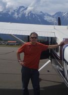
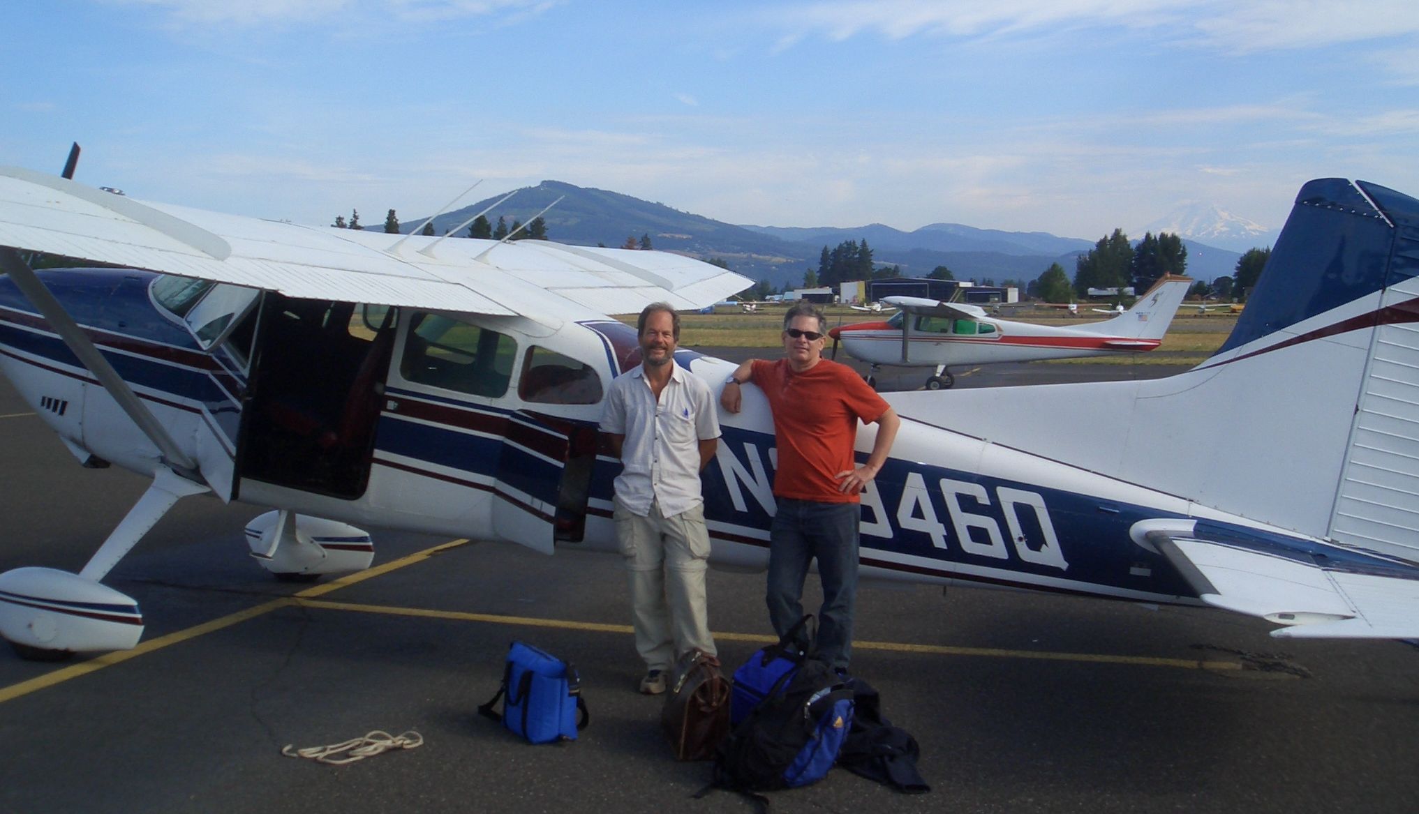
Saturday 14-Jul
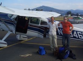
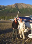
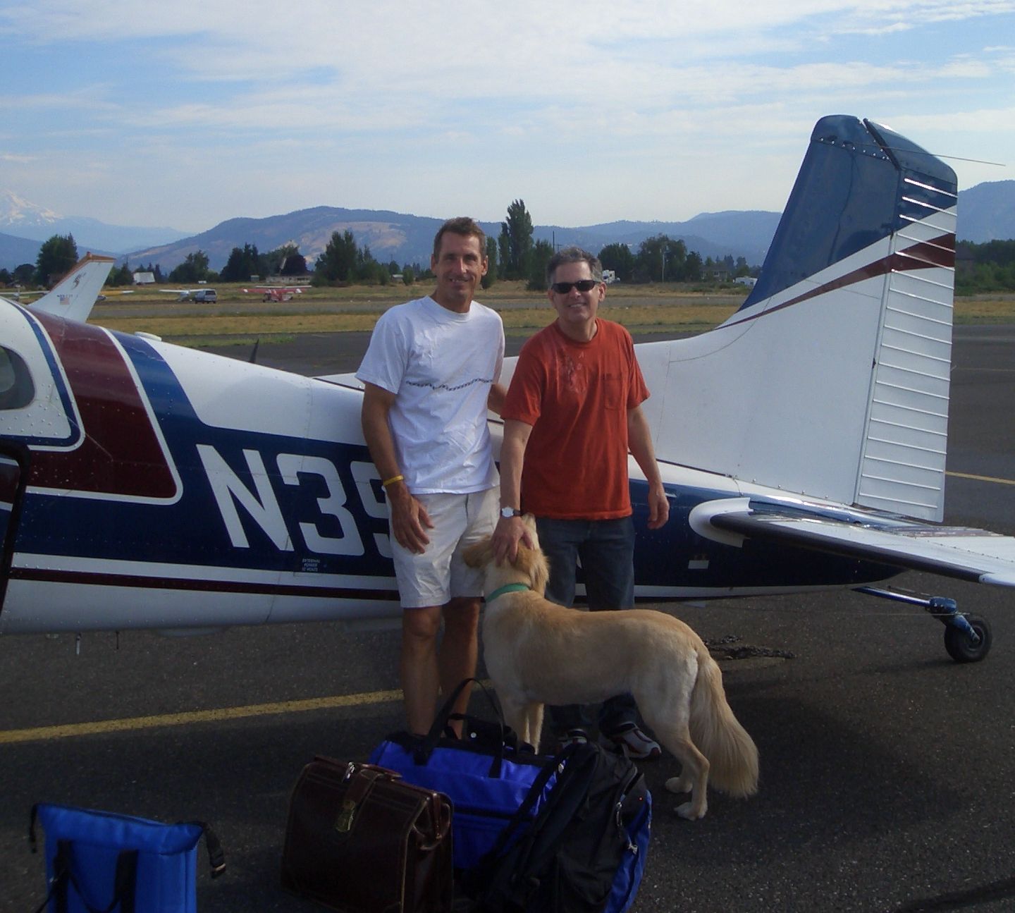
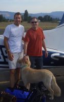 To the left are Marty and me ready to depart from Hood River. To the right
are Marty and James as well as Jennifer's dog.
To the left are Marty and me ready to depart from Hood River. To the right
are Marty and James as well as Jennifer's dog.
Click on any picture to see a larger image. Then click the back button to continue.
A later start than planned, with all the late night chatting and some in
the morning as well. Filed my border crossing flight plan and notified
customs on my cell on the way to the airport. Departed 4S2 at 9:30.
The 2 hour notification was a nuisance causing us to throttle way back
so we wouldn't bust our 11AM border crossing into Abbotsford BC.
(Lost a little time, but at least saved on fuel.) Clearing Canadian
customs was anti-climactic. Nobody was there. All I had to do was to call
CANPASS on my cell and he cleared me to enter the country immediately.
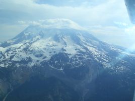
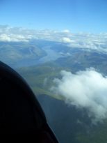
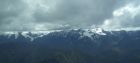
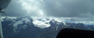
 After filling up with the expensive Canadian avgas, we departed for
Smithers BC. The usual route deviates to the east (over Prince George)
to give more bad weather options. However the weather seemed good enough
that we chose a mostly direct path. These pictures were taken about 30 minutes
after takeoff. This was our first taste of the
remote and rugged terrain common north of the border. It made me glad
I had just purchased a PLB (personal locator beacon).
After filling up with the expensive Canadian avgas, we departed for
Smithers BC. The usual route deviates to the east (over Prince George)
to give more bad weather options. However the weather seemed good enough
that we chose a mostly direct path. These pictures were taken about 30 minutes
after takeoff. This was our first taste of the
remote and rugged terrain common north of the border. It made me glad
I had just purchased a PLB (personal locator beacon).
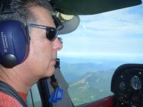
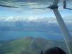
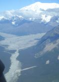
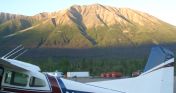
 We reached Smithers just as rain showers were starting to
form. The weather was making our plan to push on to Whitehorse, Yukon
for the night look iffy. After buying even more expensive Canadian gas,
we headed for Dease Lake instead. I took this picture shortly before takeoff.
We reached Smithers just as rain showers were starting to
form. The weather was making our plan to push on to Whitehorse, Yukon
for the night look iffy. After buying even more expensive Canadian gas,
we headed for Dease Lake instead. I took this picture shortly before takeoff.
 The weather was deteriorating, but with frequent dodges, pop overs and
duck unders around the weather we managed.
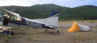
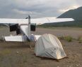
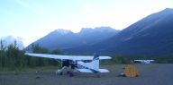
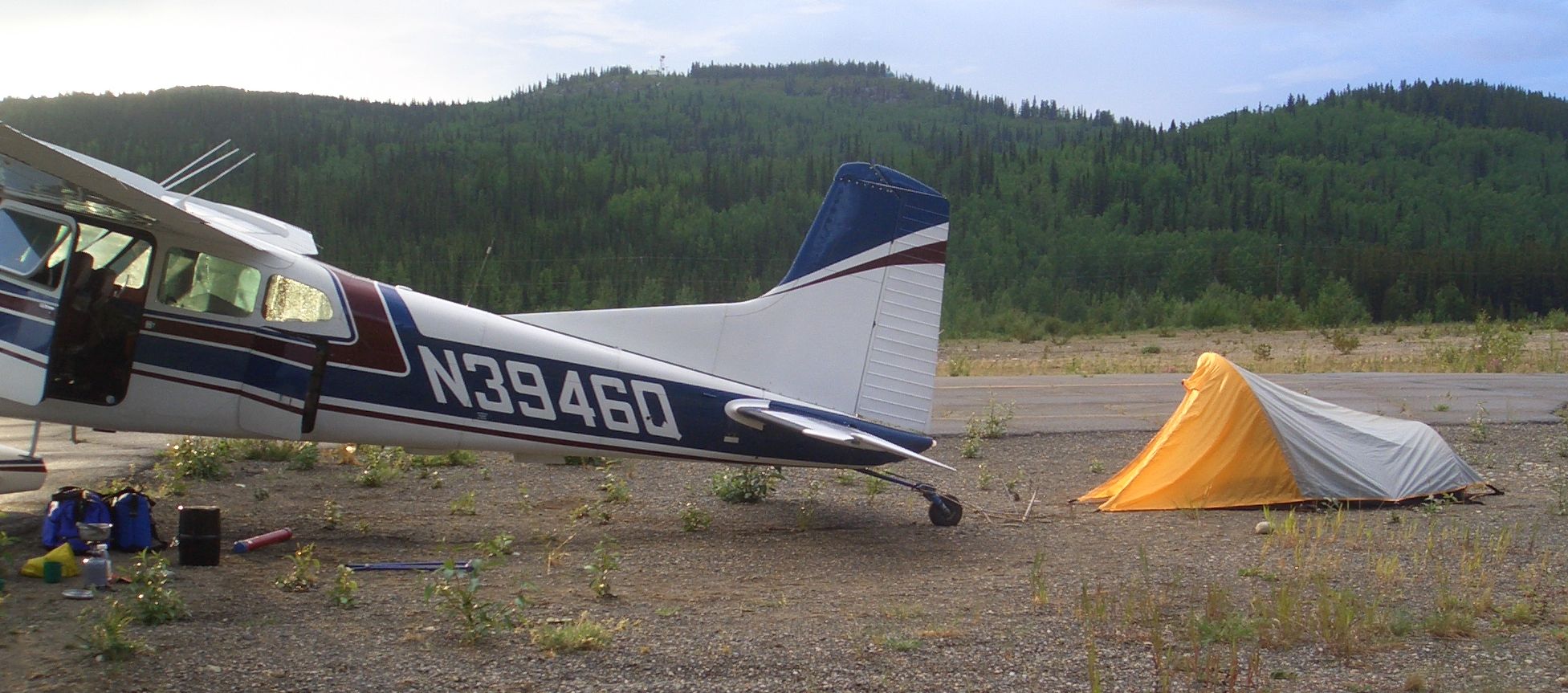
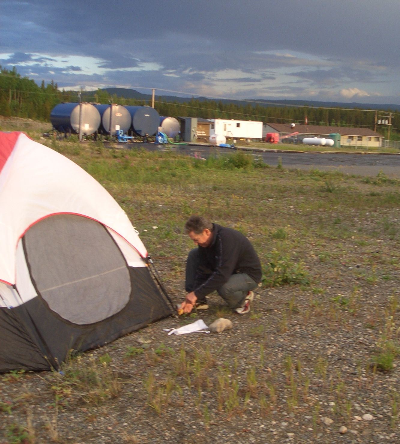
Dease Lake turned out to be a wise choice. It was a fine place to
camp (being able to use the airport restroom was a plus) and later I
learned that the gas was cheaper than Whitehorse who had perhaps the
most expensive fuel in Canada. Rain interrupted our first two attempts
to set up our tents, so we cooked dinner under the wing instead. (What
do those low wing Piper pilots do in this situation??).
The weather was deteriorating, but with frequent dodges, pop overs and
duck unders around the weather we managed.
Dease Lake turned out to be a wise choice. It was a fine place to
camp (being able to use the airport restroom was a plus) and later I
learned that the gas was cheaper than Whitehorse who had perhaps the
most expensive fuel in Canada. Rain interrupted our first two attempts
to set up our tents, so we cooked dinner under the wing instead. (What
do those low wing Piper pilots do in this situation??).
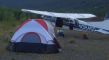
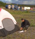 After dinner we got the tents up just before the next rain cloud moved in.
At 10:30 Marty went to bed, but it was still light, so I put on my rain jacket
and paced the long 6000 foot runway to get the flying kinks out. Then I started this
blog. Of course I'm way off grid, so it may be a while before you will
see this on my web site. I think it was 11:30 before it was dark enough
that I needed a flashlight to read.
After dinner we got the tents up just before the next rain cloud moved in.
At 10:30 Marty went to bed, but it was still light, so I put on my rain jacket
and paced the long 6000 foot runway to get the flying kinks out. Then I started this
blog. Of course I'm way off grid, so it may be a while before you will
see this on my web site. I think it was 11:30 before it was dark enough
that I needed a flashlight to read.
Tach: 1.6
Hobbs: 1:51
Gallons: 14.68
Cost: $098.79
Track: (203.8 / 210 nm)
4S2-Abbotsford.kmz
Tach: 2.3
Hobbs: 2:35
Gallons: 31.81
Cost: $241.05
Track: (390.8 / 401 nm)
Abbotsford-Smithers.kmz
Tach: 1.6
Hobbs: 1:47
Gallons: 19.47
Cost: $148.22
Track: (235.3 / 255 nm)
Smithers-Dease.kmz
Sunday, 15-Jul
 Whitehorse was directly under our straight path from Dease Lake to
Northway, AK (our US airport of entry). Marty suggested landing at
Whitehorse to "regroup", but he went along with my preference for
pressing on. I think the constant meandering thru the weather was
starting to wear on him. I thought that any delay would only make
things more challenging, and besides Whitehorse was under heavy rain
at the time.
Whitehorse was directly under our straight path from Dease Lake to
Northway, AK (our US airport of entry). Marty suggested landing at
Whitehorse to "regroup", but he went along with my preference for
pressing on. I think the constant meandering thru the weather was
starting to wear on him. I thought that any delay would only make
things more challenging, and besides Whitehorse was under heavy rain
at the time.
Our Dease Lake departure was complicated by the fact that we needed
to file a flight plan and notify US customs of our arrival with 15
minute accuracy. To make matters worse there is no cell phone service
at Dease Lake. I tried to charge the call to US customs to my Visa,
using the pay phone, but the operator said that was not possible.
Marty came to the rescue. He had an AT&T international calling card.
Without that we would have had to land at Whitehorse (which had
terrible weather). We filed for 3 hours enroute which turned out to
be exactly right, despite some more weaving dances to stay clear of
clouds. A few times it looked doubtful to make Northway, but we always
had an out so we pressed on.
When we got to Northway, another C185 was sitting at the pumps also
waiting for the customs agent. This turned out to be Nick Sealage.
We recognized each other's names from the Skywagon Discussion List.
One of Nick's suggestions sounded interesting (flying from Anchorage,
up Clark pass and Lake Clark and landing at Iliamna). I hope we have
the time to do that.
When the customs agent looked at Marty's passport he said "This photo
REALLY does not look like you (He also made a crack about gender
reassignment surgery). Marty had accidentally picked up his wife's
passport. We were lucky to have found the rare customs agent with
a sense of humor. He didn't give us any problem re-entering the country.
Shortly after that, a 3rd skywagon showed up - piloted by Merill-
field-based Kimball Forest (another name I recognized from the list.)
We all ate lunch at the airport cafe and swapped flying stories and
other half truths. Kimball was incredibly helpful with many Alaska
flying suggestions. He also gave me some charts he thought I should
have. One of his best suggestions was McCarthy, which we decided to
take on the spot.
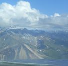
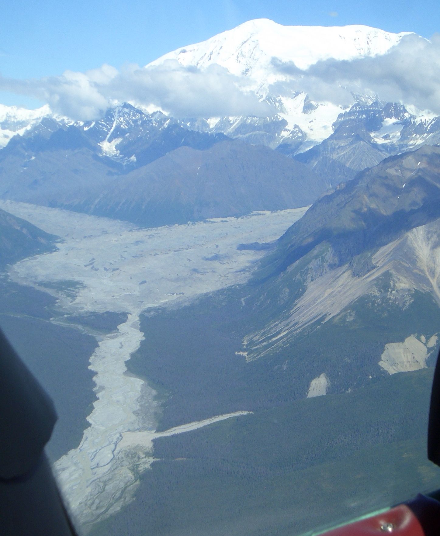
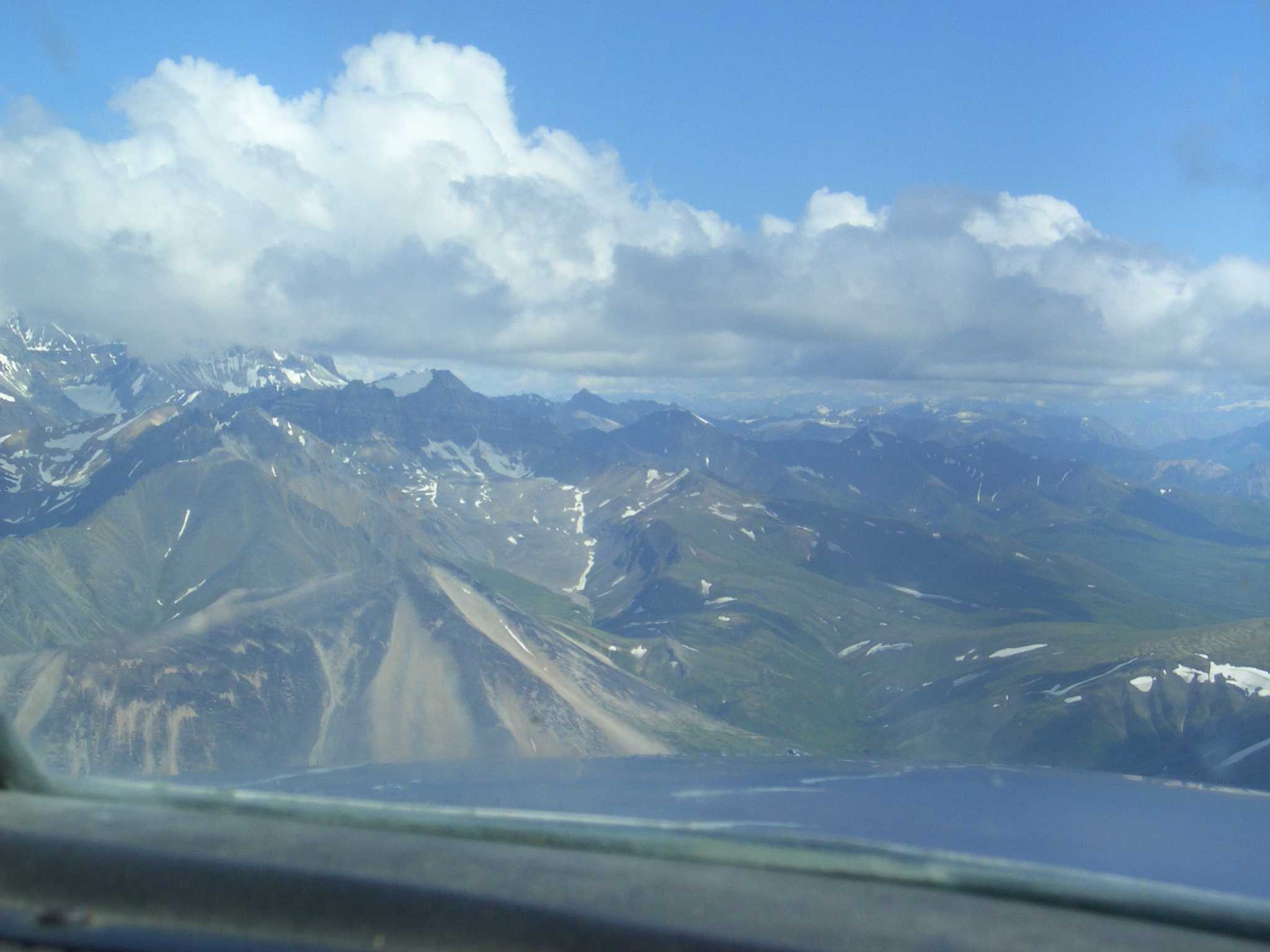
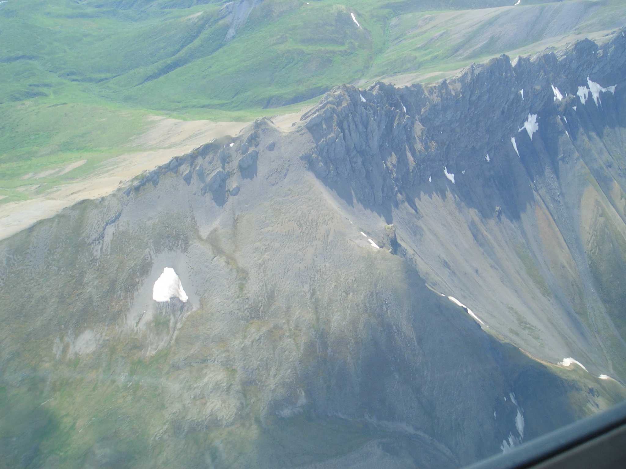
 Flight service didn't have any weather information on McCarthy, so we
decided to have a look. We could tell that the clouds were too low to
make it over any of the passes thru the Wrangell Mountains so we deviated
west to Gulkana and then up the pass to McCarthy.
Flight service didn't have any weather information on McCarthy, so we
decided to have a look. We could tell that the clouds were too low to
make it over any of the passes thru the Wrangell Mountains so we deviated
west to Gulkana and then up the pass to McCarthy.
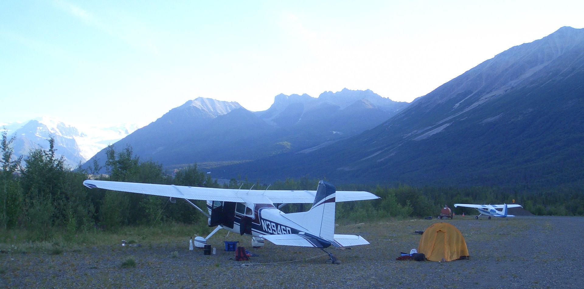
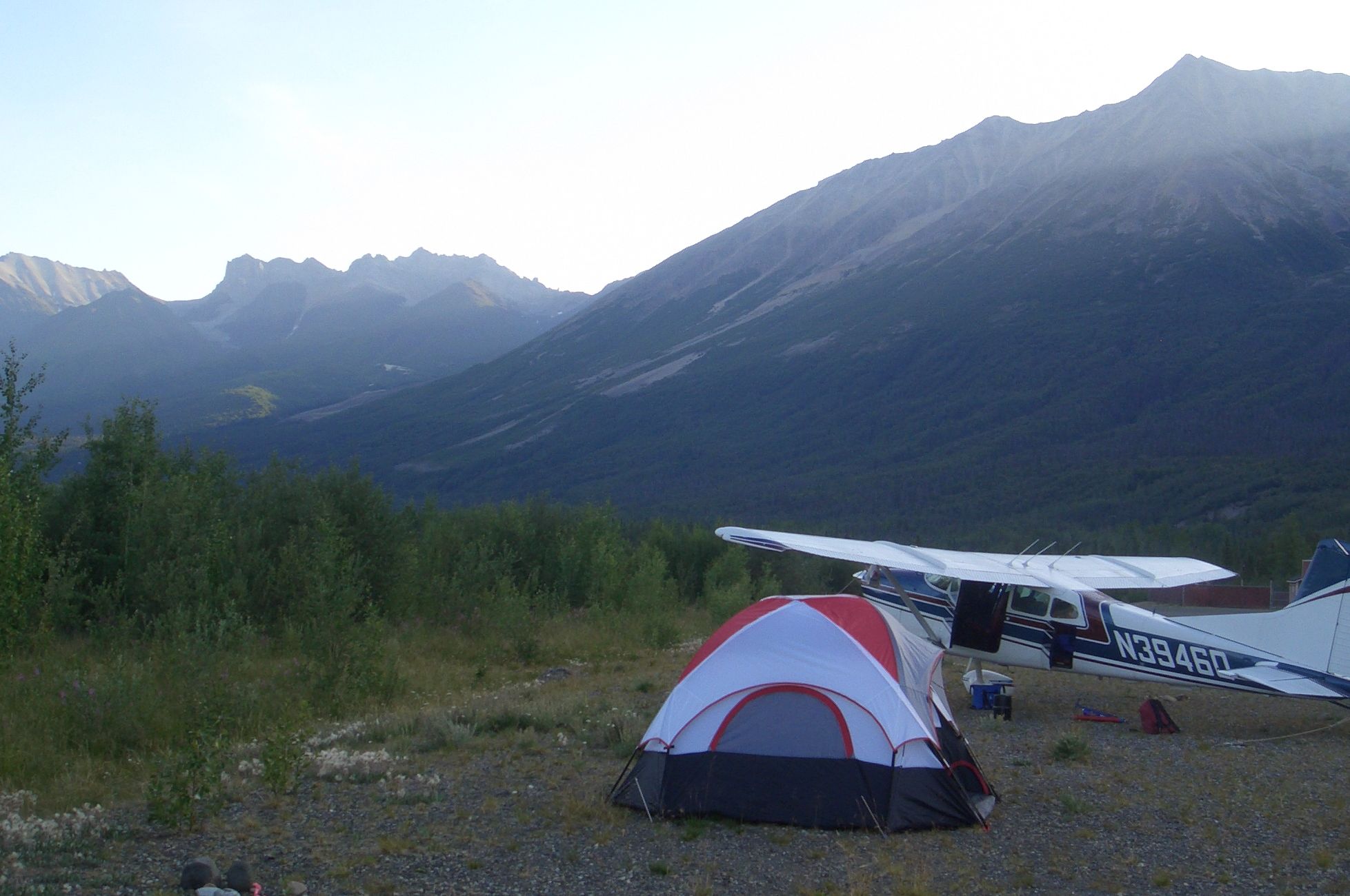
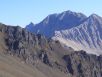
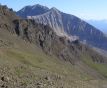
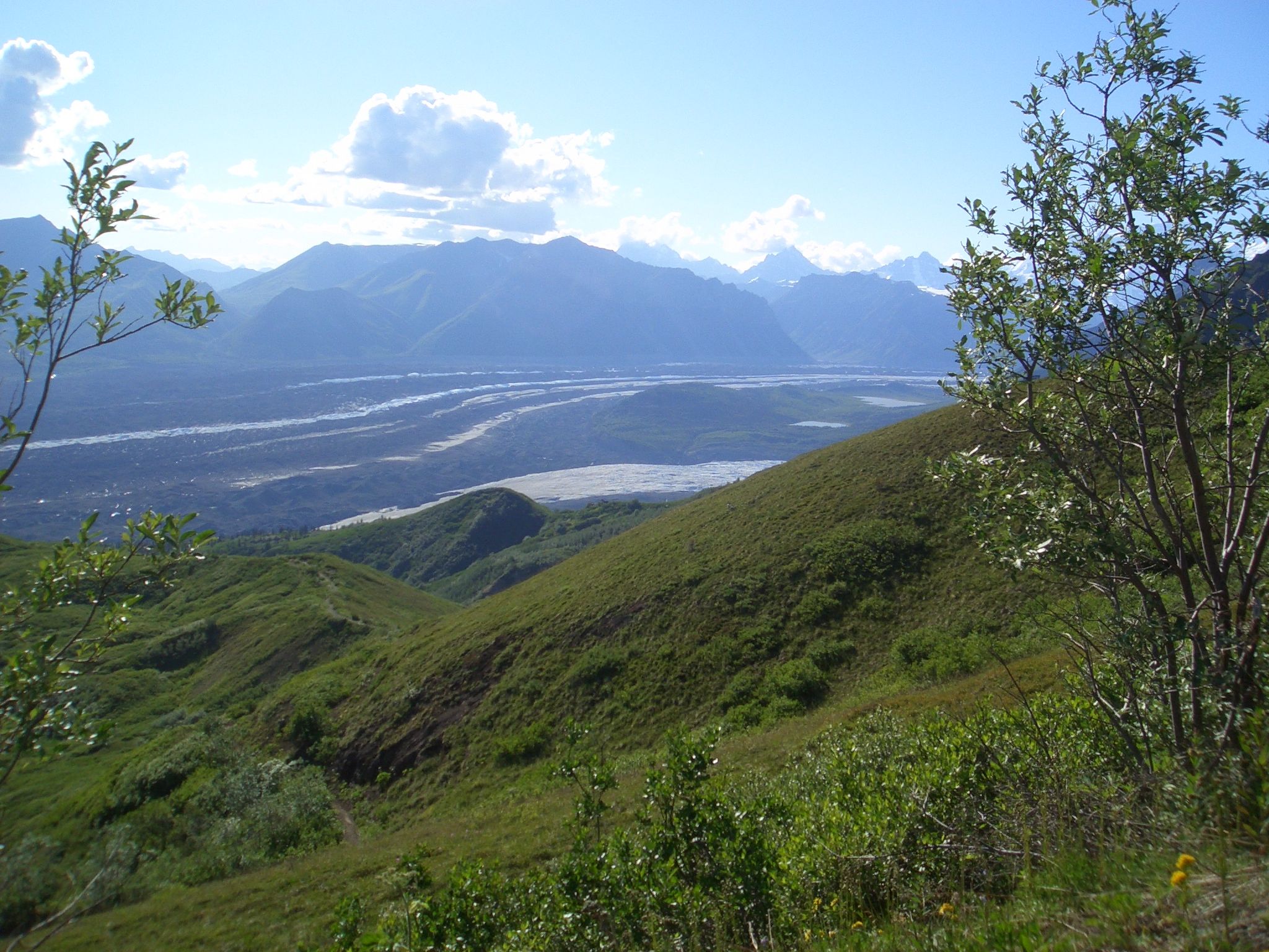
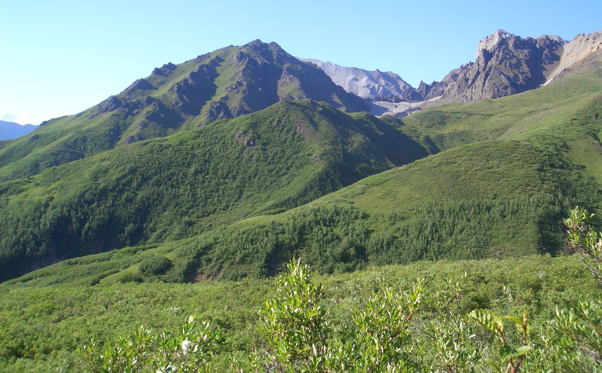
Turned out the weather
was fine and we couldn't have asked for a better spot for our first
time camping in Alaska. Beautiful views of mountains all around. And one
can pitch a tent just about anywhere.
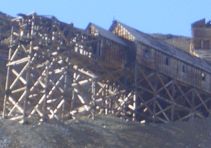
We didn't set up camp right away since Kimball had mentioned that there
were some neat mines to see in Kennecott, a 5 mile shuttle ride to the
north. So we grabbed some water and gorp and found the shuttle. It was
clear to the driver that we didn't know that it was a hike to see the
mines. She said it was a 2000 ft climb. Darn, should have brought my
hiking boots, thick socks, bandaids, and ibuprofin. But even without my
usual hiking stuff I thought I could handle 2000 feet ok.

 On the way up the road to the trail we got a trail map and bought an extra
bottle of water. The map said the round trip time to the Jumbo mine was
6 to 8 hours and that the elevation gain was not 2000 ft but 3800! It was
now 4pm giving us 4.5 hours until the last bus left for the airport, but
I was still thinking the trail might be doable in that time. (The map
estimates are calibrated to the beer gut couch potatoes.) Marty had enough
after climbing the first 800 feet and headed back down the hill. Soon after
On the way up the road to the trail we got a trail map and bought an extra
bottle of water. The map said the round trip time to the Jumbo mine was
6 to 8 hours and that the elevation gain was not 2000 ft but 3800! It was
now 4pm giving us 4.5 hours until the last bus left for the airport, but
I was still thinking the trail might be doable in that time. (The map
estimates are calibrated to the beer gut couch potatoes.) Marty had enough
after climbing the first 800 feet and headed back down the hill. Soon after
 I ditched the pack (containing much useless stuff) took out a 12 oz water
bottle and bolted uphill as fast as I could. At the top, I realized I was
alone. All the people I had met were going downhill. Scary thought of
getting stuck up here (in shorts and a light T shirt). It was a well marked
trail, but if there was a way to go wrong I usually am able to find it.
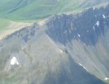
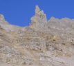
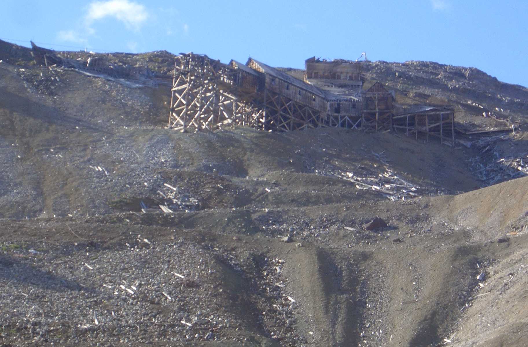
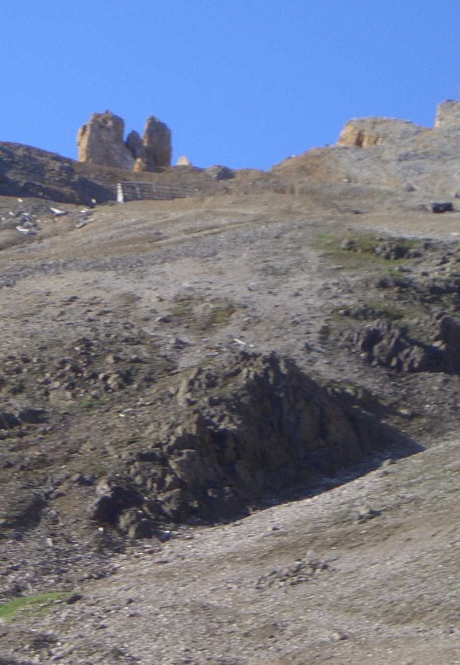
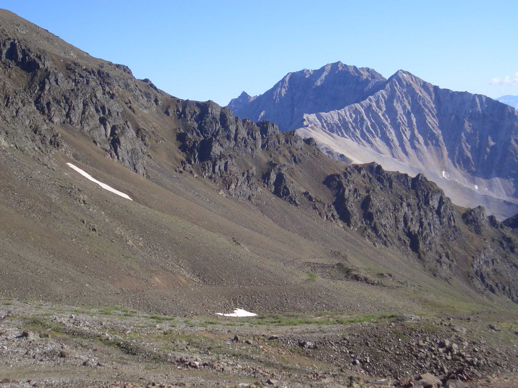
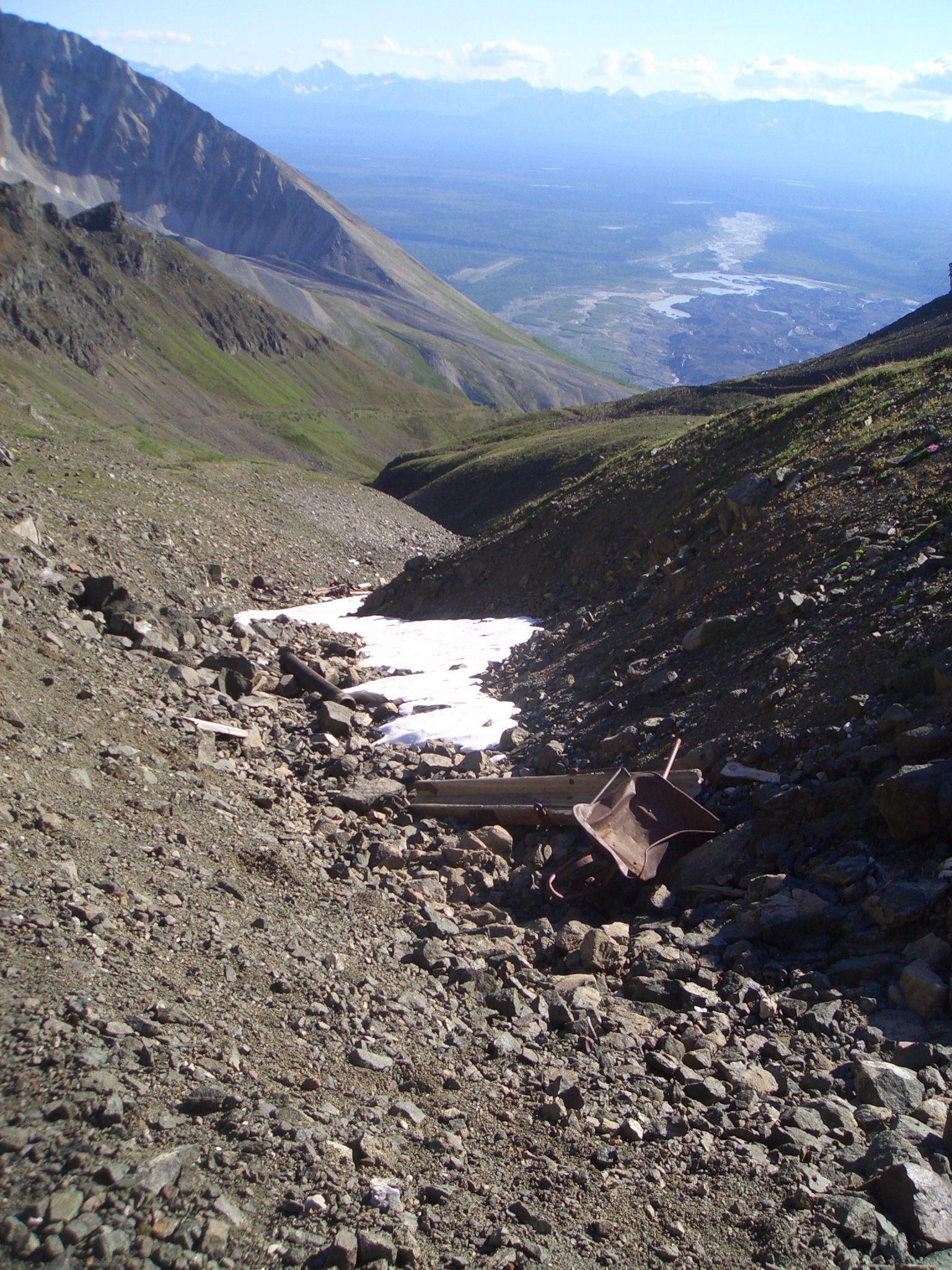
The footing wasn't particularly good either. So a few quick pictures of
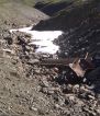
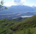
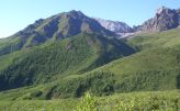
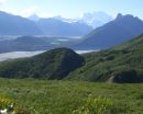
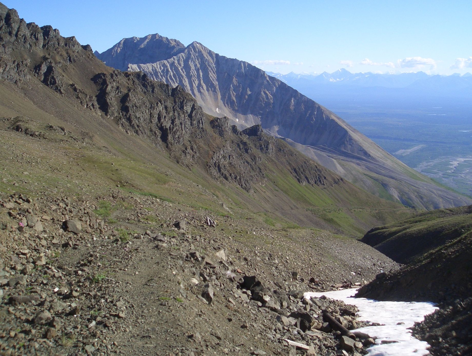
the mines and the scenery and I skidaddled. Here are four pictures I took
at the top.
I ditched the pack (containing much useless stuff) took out a 12 oz water
bottle and bolted uphill as fast as I could. At the top, I realized I was
alone. All the people I had met were going downhill. Scary thought of
getting stuck up here (in shorts and a light T shirt). It was a well marked
trail, but if there was a way to go wrong I usually am able to find it.
The footing wasn't particularly good either. So a few quick pictures of
the mines and the scenery and I skidaddled. Here are four pictures I took
at the top.
My descent was slowed however
by sections too steep to run and my "Oh wow"s that came out voiced
even though there was nobody else to hear it.
(That's when I knew I had to stop to take a picture - 7 of which are above.)
Still, I managed the round trip in 3 hours
and 12 minutes, so was able to take the 7:30 bus back to the airport.
Took me a few days to completely recover, but it was worth it. I figured
I wouldn't get another chance at that trail anytime soon. I also figured
that back at the plane I could shower by dumping water over
my head. However no water was available at the airport. We had plenty
to drink, but not enough to waste.
Meanwhile Marty did a side trip into the town of McCarthy so we made it
back to the plane at about the same time. We set up our tents and made
dinner using one of our dehydrated backpacking dinners. The one we had
the previous night was quite tasty so we were disappointed to find this
one inedibly salty. I ate some anyway only because by this time I was
HUNGRY. I thought it was a manufacturing defect until I read the label.
"1790 mg sodium PER SERVING". What were they thinking??? That will teach
me to read the labels first.

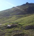
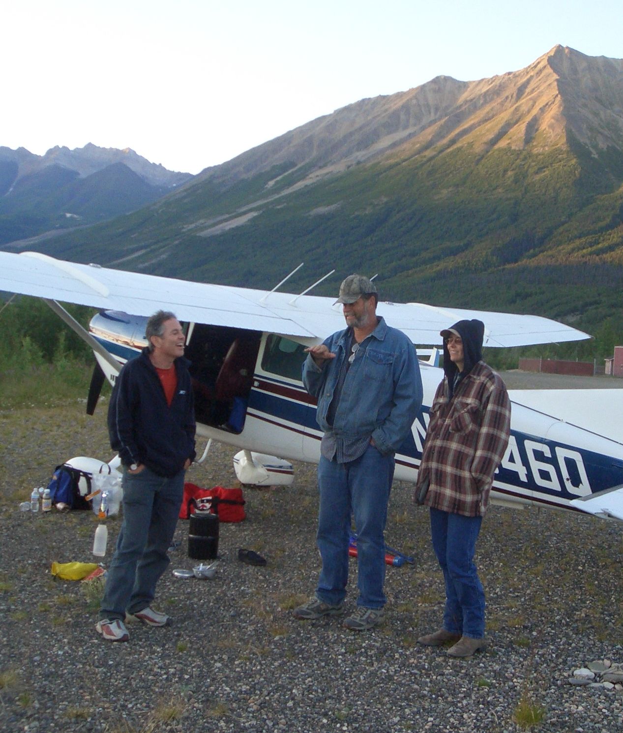
 In the evening we talked quite a bit with a couple camped near us,
who flew all the way from southern Illinois (picture on the left).
One of the camping spot suggestions they made was "Lake Minchumina".
That turned out to be a fruitful conversation.
In the evening we talked quite a bit with a couple camped near us,
who flew all the way from southern Illinois (picture on the left).
One of the camping spot suggestions they made was "Lake Minchumina".
That turned out to be a fruitful conversation.
It's now 15 minutes past midnight and just starting to get a bit
difficult to write without a flashlight. So I'll sign off for today.
Actually I think it should be 1:15 if we were in the rightful time zone.
(Eastern and western AK both shift by an hour so they can use the
same time zone as central Alaska).
Tach: 2.7
Hobbs: 3:02
Gallons: 43.5
Cost: $247.52
Track: (441.9 / 461 nm)
Dease-Northway.kmz
Tach: 1.3
Hobbs: 1:26
Gallons: 00.0
Cost: $000.00
Track: (095.4 / 177 nm)
Northway-McCarthy.kmz
Click here to continue to part 2 (Monday, 16-Jul).
Click here to skip ahead to part 3 (Saturday, 21-Jul).
Click here to skip ahead to part 4 (Wednesday, 25-Jul).
Click here to go back to the mennen.org home page.
 To the left are Marty and me ready to depart from Hood River. To the right
are Marty and James as well as Jennifer's dog.
To the left are Marty and me ready to depart from Hood River. To the right
are Marty and James as well as Jennifer's dog.

 After filling up with the expensive Canadian avgas, we departed for
Smithers BC. The usual route deviates to the east (over Prince George)
to give more bad weather options. However the weather seemed good enough
that we chose a mostly direct path. These pictures were taken about 30 minutes
after takeoff. This was our first taste of the
remote and rugged terrain common north of the border. It made me glad
I had just purchased a PLB (personal locator beacon).
After filling up with the expensive Canadian avgas, we departed for
Smithers BC. The usual route deviates to the east (over Prince George)
to give more bad weather options. However the weather seemed good enough
that we chose a mostly direct path. These pictures were taken about 30 minutes
after takeoff. This was our first taste of the
remote and rugged terrain common north of the border. It made me glad
I had just purchased a PLB (personal locator beacon).
 We reached Smithers just as rain showers were starting to
form. The weather was making our plan to push on to Whitehorse, Yukon
for the night look iffy. After buying even more expensive Canadian gas,
we headed for Dease Lake instead. I took this picture shortly before takeoff.
We reached Smithers just as rain showers were starting to
form. The weather was making our plan to push on to Whitehorse, Yukon
for the night look iffy. After buying even more expensive Canadian gas,
we headed for Dease Lake instead. I took this picture shortly before takeoff.
 The weather was deteriorating, but with frequent dodges, pop overs and
duck unders around the weather we managed.
Dease Lake turned out to be a wise choice. It was a fine place to
camp (being able to use the airport restroom was a plus) and later I
learned that the gas was cheaper than Whitehorse who had perhaps the
most expensive fuel in Canada. Rain interrupted our first two attempts
to set up our tents, so we cooked dinner under the wing instead. (What
do those low wing Piper pilots do in this situation??).
The weather was deteriorating, but with frequent dodges, pop overs and
duck unders around the weather we managed.
Dease Lake turned out to be a wise choice. It was a fine place to
camp (being able to use the airport restroom was a plus) and later I
learned that the gas was cheaper than Whitehorse who had perhaps the
most expensive fuel in Canada. Rain interrupted our first two attempts
to set up our tents, so we cooked dinner under the wing instead. (What
do those low wing Piper pilots do in this situation??).
 After dinner we got the tents up just before the next rain cloud moved in.
At 10:30 Marty went to bed, but it was still light, so I put on my rain jacket
and paced the long 6000 foot runway to get the flying kinks out. Then I started this
blog. Of course I'm way off grid, so it may be a while before you will
see this on my web site. I think it was 11:30 before it was dark enough
that I needed a flashlight to read.
After dinner we got the tents up just before the next rain cloud moved in.
At 10:30 Marty went to bed, but it was still light, so I put on my rain jacket
and paced the long 6000 foot runway to get the flying kinks out. Then I started this
blog. Of course I'm way off grid, so it may be a while before you will
see this on my web site. I think it was 11:30 before it was dark enough
that I needed a flashlight to read.

 Whitehorse was directly under our straight path from Dease Lake to
Northway, AK (our US airport of entry). Marty suggested landing at
Whitehorse to "regroup", but he went along with my preference for
pressing on. I think the constant meandering thru the weather was
starting to wear on him. I thought that any delay would only make
things more challenging, and besides Whitehorse was under heavy rain
at the time.
Whitehorse was directly under our straight path from Dease Lake to
Northway, AK (our US airport of entry). Marty suggested landing at
Whitehorse to "regroup", but he went along with my preference for
pressing on. I think the constant meandering thru the weather was
starting to wear on him. I thought that any delay would only make
things more challenging, and besides Whitehorse was under heavy rain
at the time.

 Flight service didn't have any weather information on McCarthy, so we
decided to have a look. We could tell that the clouds were too low to
make it over any of the passes thru the Wrangell Mountains so we deviated
west to Gulkana and then up the pass to McCarthy.
Flight service didn't have any weather information on McCarthy, so we
decided to have a look. We could tell that the clouds were too low to
make it over any of the passes thru the Wrangell Mountains so we deviated
west to Gulkana and then up the pass to McCarthy.
 On the way up the road to the trail we got a trail map and bought an extra
bottle of water. The map said the round trip time to the Jumbo mine was
6 to 8 hours and that the elevation gain was not 2000 ft but 3800! It was
now 4pm giving us 4.5 hours until the last bus left for the airport, but
I was still thinking the trail might be doable in that time. (The map
estimates are calibrated to the beer gut couch potatoes.) Marty had enough
after climbing the first 800 feet and headed back down the hill. Soon after
On the way up the road to the trail we got a trail map and bought an extra
bottle of water. The map said the round trip time to the Jumbo mine was
6 to 8 hours and that the elevation gain was not 2000 ft but 3800! It was
now 4pm giving us 4.5 hours until the last bus left for the airport, but
I was still thinking the trail might be doable in that time. (The map
estimates are calibrated to the beer gut couch potatoes.) Marty had enough
after climbing the first 800 feet and headed back down the hill. Soon after
 I ditched the pack (containing much useless stuff) took out a 12 oz water
bottle and bolted uphill as fast as I could. At the top, I realized I was
alone. All the people I had met were going downhill. Scary thought of
getting stuck up here (in shorts and a light T shirt). It was a well marked
trail, but if there was a way to go wrong I usually am able to find it.
The footing wasn't particularly good either. So a few quick pictures of
the mines and the scenery and I skidaddled. Here are four pictures I took
at the top.
I ditched the pack (containing much useless stuff) took out a 12 oz water
bottle and bolted uphill as fast as I could. At the top, I realized I was
alone. All the people I had met were going downhill. Scary thought of
getting stuck up here (in shorts and a light T shirt). It was a well marked
trail, but if there was a way to go wrong I usually am able to find it.
The footing wasn't particularly good either. So a few quick pictures of
the mines and the scenery and I skidaddled. Here are four pictures I took
at the top.


 In the evening we talked quite a bit with a couple camped near us,
who flew all the way from southern Illinois (picture on the left).
One of the camping spot suggestions they made was "Lake Minchumina".
That turned out to be a fruitful conversation.
In the evening we talked quite a bit with a couple camped near us,
who flew all the way from southern Illinois (picture on the left).
One of the camping spot suggestions they made was "Lake Minchumina".
That turned out to be a fruitful conversation.